 |
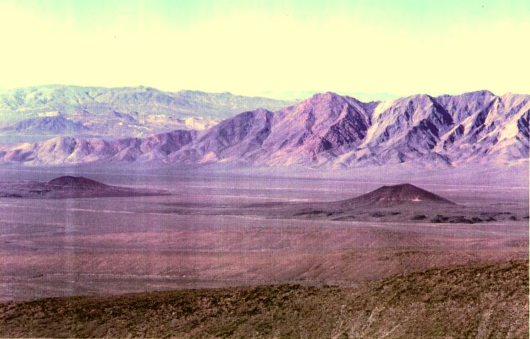
This is a picture taken from the top of Yucca Mountain looking west toward California. In the foreground are two volcanic cinder cones. The photo was taken from the top of Yucca Mountain by a State researcher. |
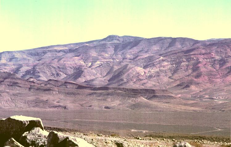 |
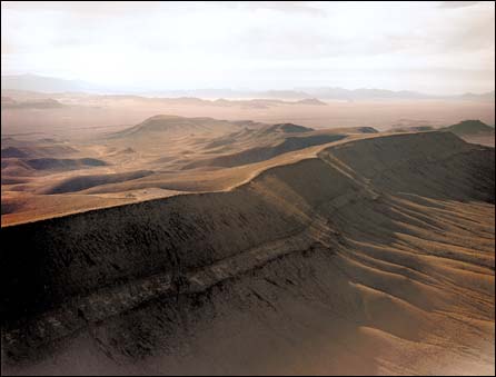
This is picture of Crater Flat on the edge of the Nevada Test Site (NTS). This photo was taken from the top of Yucca Mountain by a State researcher. The direction of view is to the northeast looking from the top of Yucca Mountain into the NTS. |
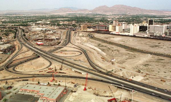 |
The Las Vegas Spaghetti Bowl and Union Pacific Railroad tracks may be used to transport high-level nuclear waste to Yucca Mountain. Both the freeway interchange and the railroad tracks run close to downtown Las Vegas. |
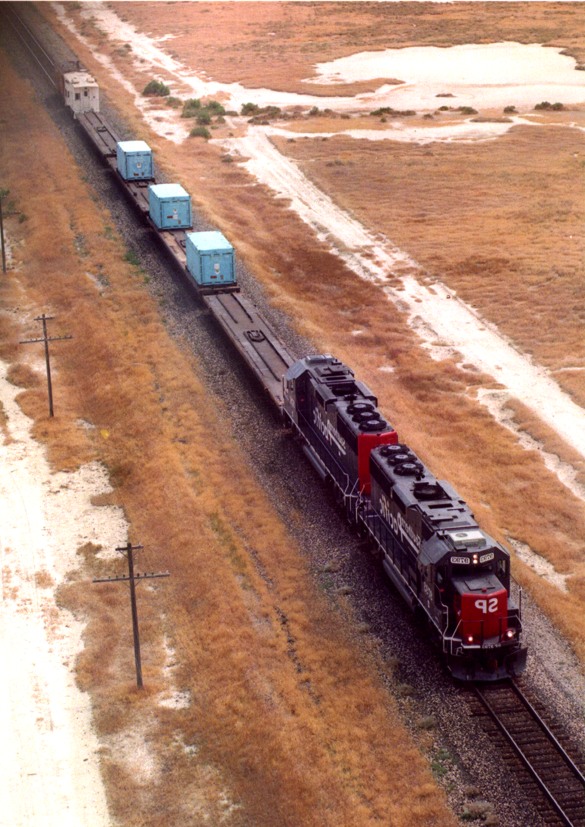 |
In 1998 the U.S. Department of Energy (DOE) initiated one of three planned shipments of foreign research reactor spent nuclear fuel from the Concord Naval shipping yard located near San Francisco to DOE's Idaho Engineering Laboratory in easter Idaho. The fuel was off-loaded and "railed" through California and Nevada. |
|
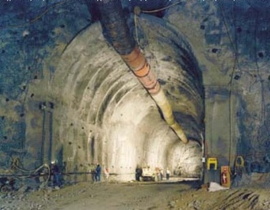
To assess the potential suitability of Yucca Mountain, the U.S. Department of Energy initiated the construction of the Exploratory Studies Facility (ESF). The ESF will also function as the entrance to Yucca Mountain if the site is ever "licensed" by the Nuclear Regulatory Commission for disposal of civilian spent nuclear fuel and defense High-Level Waste. |
|
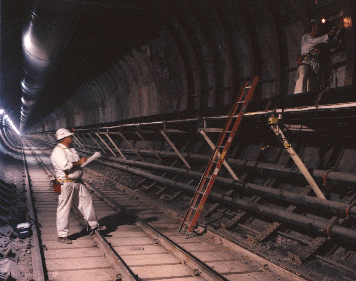
Each week, scientists inside Yucca Mountain download information onto laptop computers from instruments installed in the steel sets in the tunnel. The data is gathered to assess whether the tunnel is expanding or contracting. |
 |
This is a full view of Yucca Mountain. The point of direction is from the northeast to the southwest toward Amagosa and the Pahurmp Valley. The site occupies lands controlled by the U.S. Department of Energy, the U.S. Air Force (Nellis Range), and the Bureau of Land Management. |
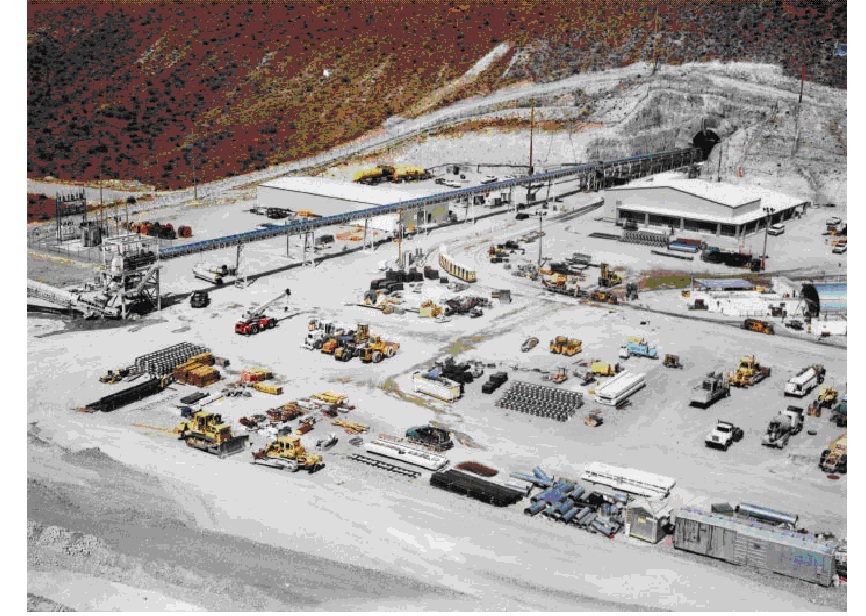 |
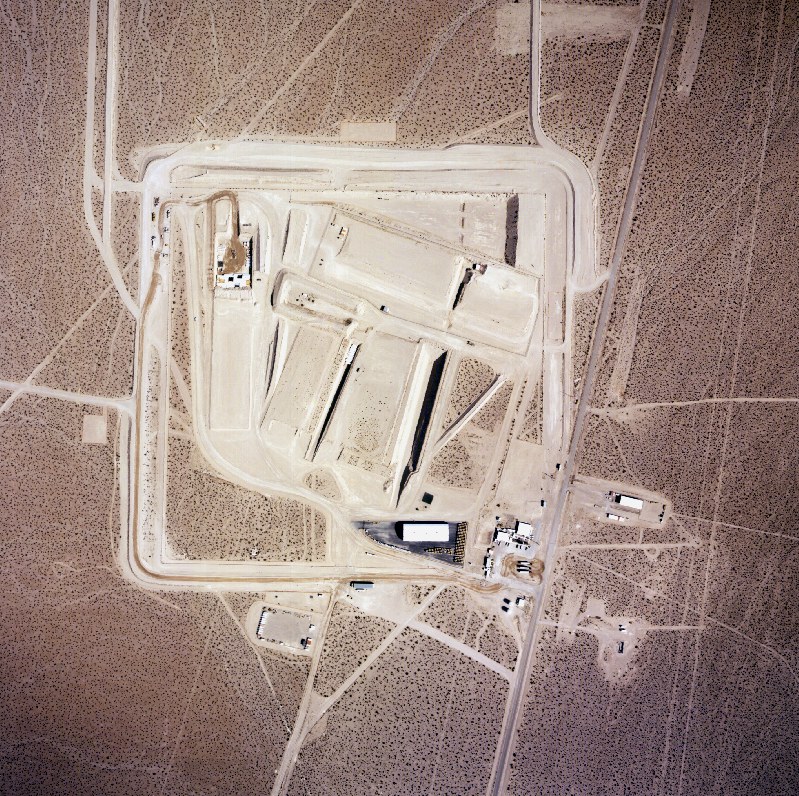
This is a partial view of the north portal surface facilities of the Exploratory Studies Facility, - June 1998 |
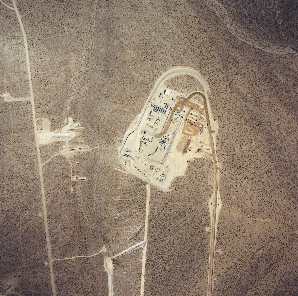 |
This is an aerial photo of the Exploratory Studies Facility (ESF) at Yucca Mountain. The ESF is actually the tunnel entrance to the first 5 mile tunnel loop in Yucca Mountain. The photo was taken in August 1994 as part of the aerial mapping of the Nevada Test Site (NTS). |
 |
This is an aerial photo of the U.S. Department of Energy's Area 5 Low-Level Waste (LLW) disposal facility. The site is located on the Nevada Test Site (NTS) in Frenchmen Flat. Yucca Mountain is located about 15 miles due west of the site. DOE has disposed of millions of cubic feet of LLW at the Area 5 facility. |
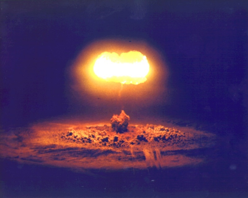 |
View of an above ground atmospheric nuclear test conducted at the Nevada Test Site on August 7, 1957. The tests was called Stokes and was conducted as part the operation "Plumbbob" testing events. Stokes was a 19 kiloton device exploded from a balloon.. (Expandable Image 95KB) |
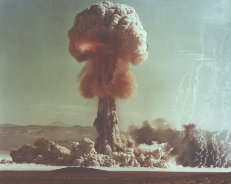 |
This above ground atmospheric nuclear test was conducted at the Nevada Test Site on May 25, 1953. Named "Grable" the nuclear bomb was fired from a 280 mm gun. The test was an Airburst, it was weapons related and had an estimated yield range of 15 Kiloton. ( Expandable Image 95KB) |